Category:Anne Beadell Highway
Jump to navigation
Jump to search
Remote road in South Australia and Western Australia   | |||||
| Upload media | |||||
| Instance of | |||||
|---|---|---|---|---|---|
| Location |
| ||||
| Connects with | |||||
| Manufacturer |
| ||||
| Length |
| ||||
 | |||||
Subcategories
This category has only the following subcategory.
I
- Ilkurlka, Western Australia (1 F)
Media in category "Anne Beadell Highway"
The following 19 files are in this category, out of 19 total.
-
 Anne Beadell Highway (banner 1).jpg 3,648 × 521; 328 KB
-
 Anne Beadell Highway 0116.svg 1,072 × 469; 77 KB
-
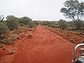 Anne Beadell Highway 2006.jpg 1,600 × 1,200; 444 KB
-
 Anne Beadell Highway banner.JPG 3,648 × 521; 434 KB
-
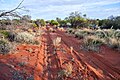 Anne Beadell Highway just west of Emu.jpg 2,048 × 1,365; 1.55 MB
-
 Anne Beadell Highway v300.png 1,073 × 470; 177 KB
-
 Anne Beadell Highway v300.svg 1,072 × 469; 157 KB
-
 Anne Beadell Highway.JPG 3,648 × 2,736; 1.53 MB
-
 Anne Beadell Highway.jpg 3,648 × 2,736; 1.34 MB
-
 Anne Beadell Highway.png 292 × 230; 53 KB
-
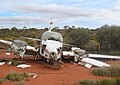 Anne Beadell Hwy plane wreck.jpg 1,416 × 1,002; 213 KB
-
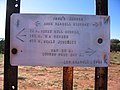 Beadell Sign at Anne's Corner 5618.jpg 1,600 × 1,200; 455 KB
-
 Beadell sign to Mt Davies.JPG 1,600 × 1,200; 993 KB
-
 Neale Junction - Len Beadell marker.jpg 2,336 × 3,504; 2.68 MB
-
 Neale Junction Marker.jpg 1,512 × 2,016; 615 KB
-
 Old Yeo Homestead.jpg 2,016 × 1,512; 840 KB
-
 Road Sign at Mabel Creek Station.JPG 3,456 × 2,304; 4.9 MB
-
 Tempo Limit.JPG 2,016 × 1,512; 1.19 MB
-
 Westaustralian Border.JPG 2,016 × 1,512; 715 KB


.jpg)